Sachez où vous êtes !
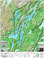
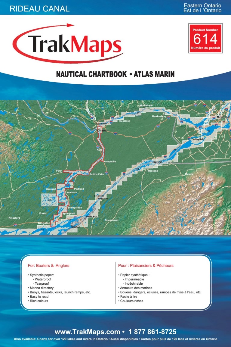
Mississippi Lake
Expédition AUJOURD'HUI ou prochain jour ouvrable avec livraison 1-3 jours ouvrables plus tard pour plusieurs endroits
Imprimé sur papier synthétique IMPERMÉABLE ET RÉSISTANT AUX DÉCHIRURES
Vous cherchez à obtenir une licence pour ces données cartographiques à des fins commerciales ou professionnelles ?
COMMANDEZ-LA AUJOURD'HUI
Spécifications
| Product # | 234 |
| Format | Individual Chart |
| Presentation | Rolled |
| Legend | |
| Finish | Synthetic |
| Region | Ottawa Valley |
| Dimensions | 20" x 28" |
| Pages | 1 |
| Scale | 1:22,000 |
| UPC | 838510002340 |
| Please note that map dimensions are sometimes rounded rounded. To obtain precise dimensions, please contact us. | |
Caractéristiques
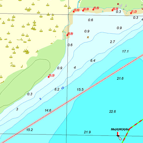
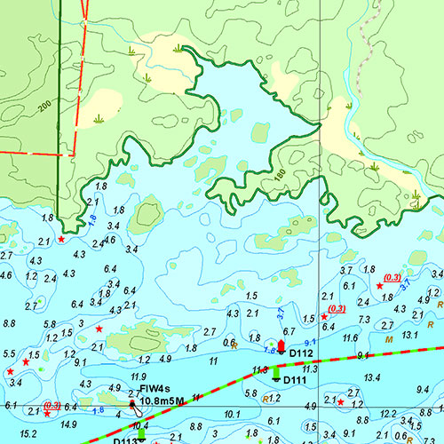
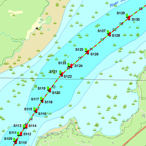
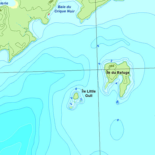
- Bathymetry
- Navigation hazards
- Main roads
- Marshes
- Fishing spots
- Marinas
- Launch ramps
- Camping sites
- Picnic sites
- Topography in 3D
- Printed on waterproof and tear-proof synthetic paper
Description
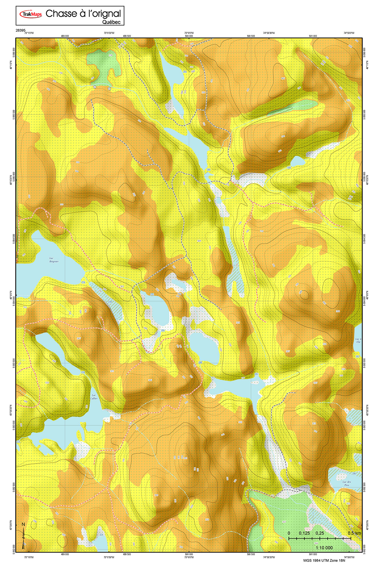
Individual Chart of Mississippi Lake in Ottawa Valley (Ontario). Printed on waterproof and tear-proof paper at a scale of 1:22,000. Perfect for fishing, boating and ice fishing.
Couverture
Pas certain quelles cartes vous devez commander? Planifiez un voyage et nous vous indiquerons celles dont vous aurez besoin.
Le rectangle rouge dans la carte ci-dessus sert uniquement à indiquer l'étendue du produit. Il ne représente pas le contenu du produit.
Trouver d'autres cartes
Je m'en vais à
| # | Produit | Format | Région | Prix |
|---|
Couverture de presse
Témoignages


Nos partenaires
Nous travaillons avec une grande variété d'associations, de fédérations, de ministères et d'entreprises pour vous offrir les meilleurs produits sur le marché.