Ce qui est inclus
- Points chauds de chasse
- Salines potentielles
- Terres de la couronne
- Terres autochtones
- Données forestières
- Zones de chasse
- Chemins forestiers routables
- Données topographiques, y compris montagnes, collines, vallées, lacs, rivières, ruisseaux, zones humides, zones forestières
- Réseau de transport routable, haltes routières
- Sentiers de randonnée
- Parcours de canot-camping
- Rivages détaillés de lacs et rivières
- Parcs nationaux et provinciaux, réserves fauniques
- Sentiers de VTT et de motoneige**
- Camps de pourvoiries & trappeurs, postes d’accueil de plein air, abris sommaires
- Rampes de mise à l’eau
- Tours de cellulaire
- Bâtiments, pylônes, lignes électriques, ponts, barrages, voies ferrées, autres points de repère
- POI : pourvoiries, hôtels, restaurants, postes d’essence, guichets automatiques
* Sentiers non-officiels inclus pour fin d’identification seulement. Nous recommandons fortement aux quadistes et motoneigistes d’utiliser les sentiers officiels et fédérés disponibles dans les produits TrakMaps Quad Ontario et Motoneige Ontario.
Description
Points chauds de chasse pour l'Ontario: CHEVREUIL
Chasse Ontario Chevreuil est l'outil cartographique essentiel pour trouver des points chauds de chasse au chevreuil en Ontario.
- Mise à jour
- 2022-01-21 · Voir le journal
- Échelle
- 1/10 000 et 1/20 000
- Taille
- 1,1 Go+
- Configuration
- Appareil GPS Garmin compatible · Garmin BaseCamp pour Windows 10 ou macOS (ou plus récent) pour affichage sur ordinateur
- Sources
- MRNF de l’Ontario, Resources naturelles Canada, Parcs Canada, TrakMaps
Couverture
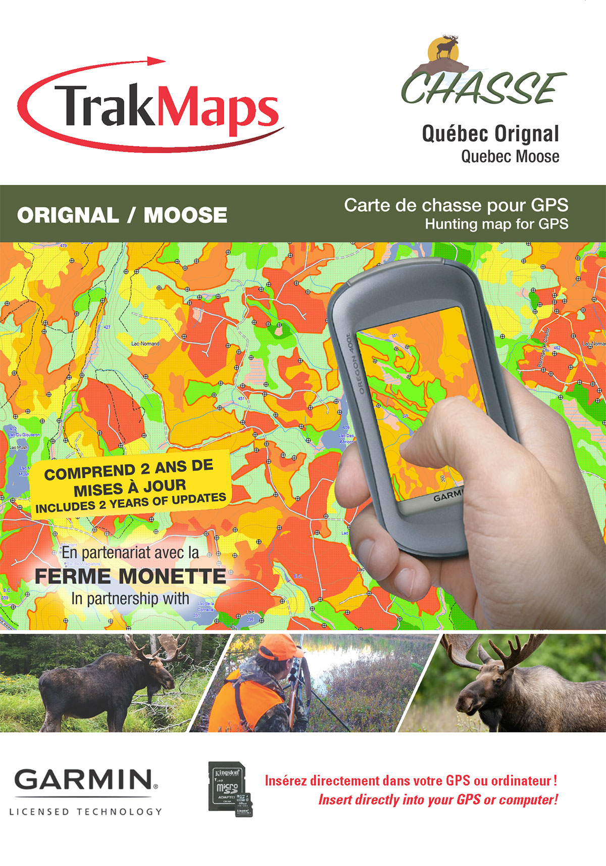
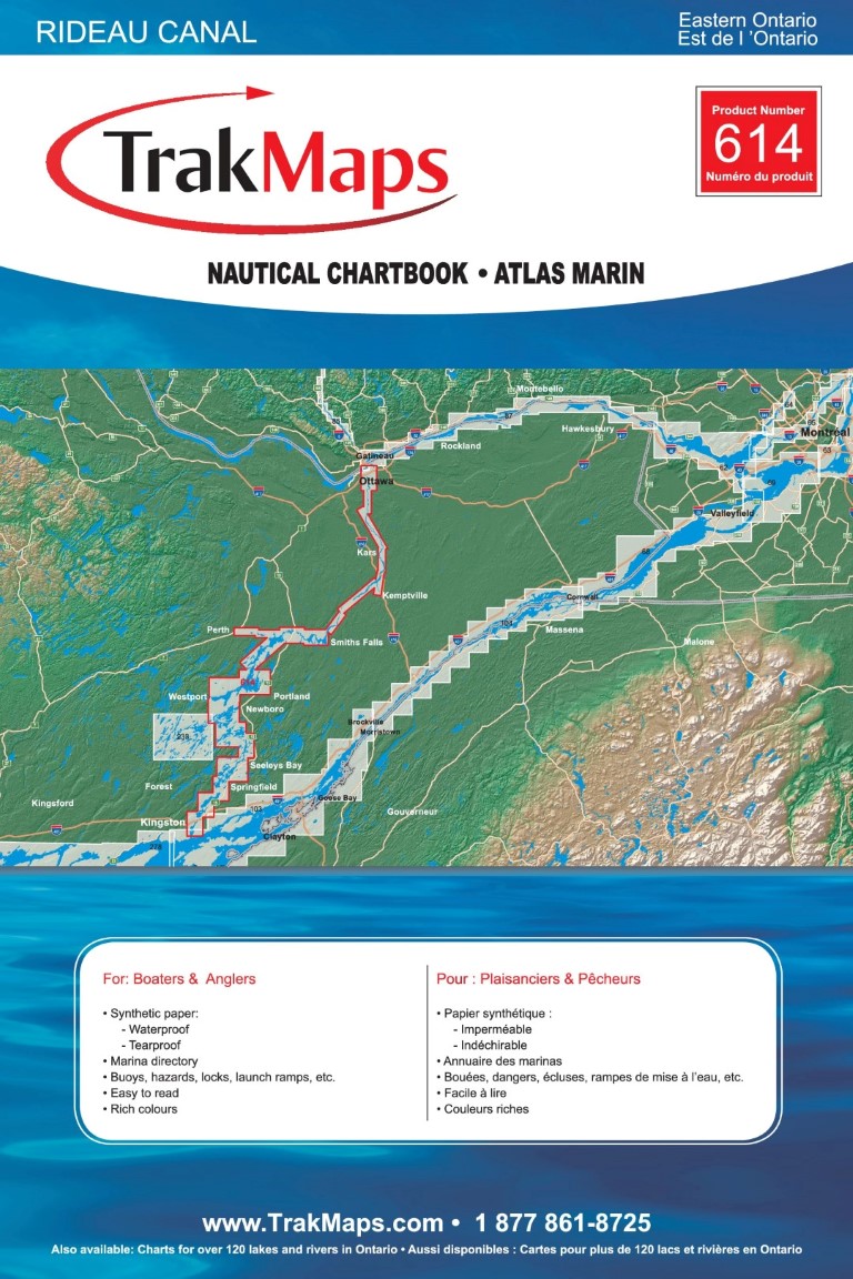
La carte de couverture ci-dessus n'est pas une capture d'écran du produit.
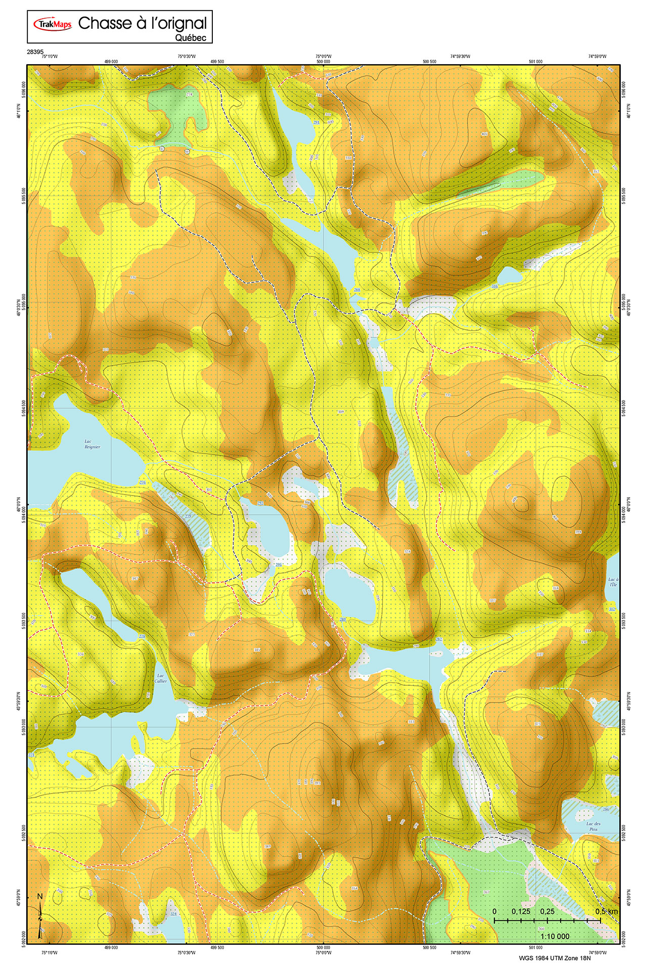
Captures d'écran
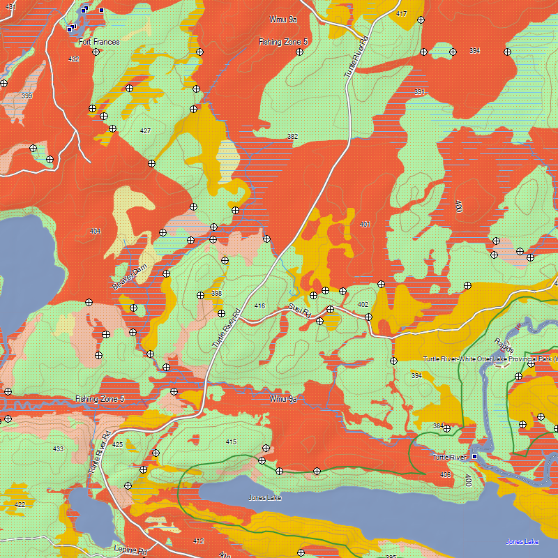
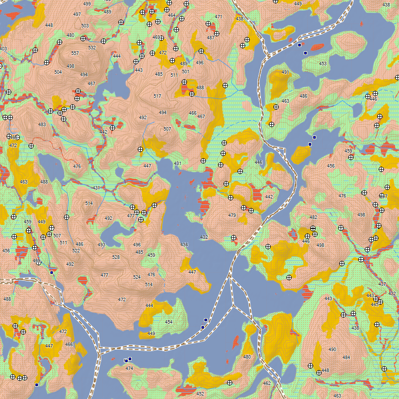
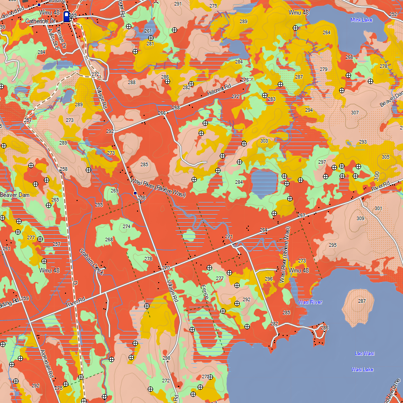
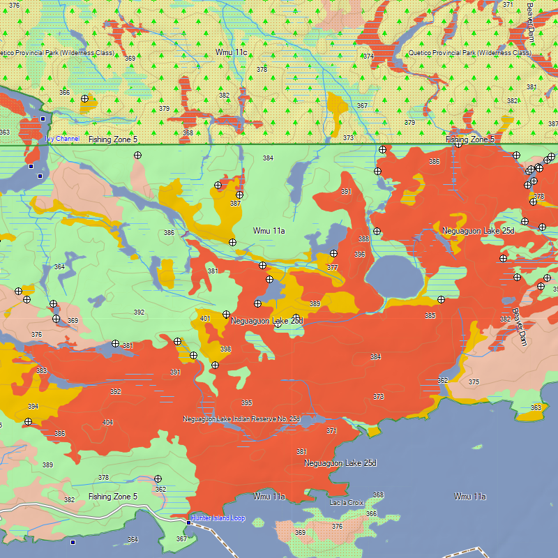
Pourquoi TrakMaps
Votre carte vous localise en temps réel pour ne pas vous perdre.
Obtenez les derniers sentiers avec TrakUpdate. Renouvelez à 50% de rabais.
Support de première classe par clavardage et courriel, en français et en anglais.
Planifiez vos sorties dans Garmin BaseCamp pour Windows ou Mac.
Tout est sur l'appareil GPS — aucun forfait de données requis.
Obtenez un rabais en passant à TrakMaps. Certaines restrictions s'appliquent. Contactez-nous pour en savoir plus
Légende
Symboles de la carte et types de sentiers
 Clothing Retail
 Golf Course
 Beach
Beach
 Police Station
 Small City
 House
House
 Woods
Woods
 Flat
Flat
 Transit Services
 Gas Station
 Ski Center
 Museum
 Utility
 Restrooms
 Picnic Area
 Bar
Bar
 Bank
Bank
 Lake
Lake
 Trail
Trail
 Hotel
Hotel
 Hospital
 Waterfall
 Sea
Sea
 Boat Ramp
 Large City
 Gov Office
 Ice Skating
 Bridge
 Light Undefined
 Grocery Store
 Rapids
 Theme Park
 Parking
 Campground
 School
 Cemetery
 Shopping Center
 Restaurant
 Library
 Arena
Arena
 Auto Club
 Stream
 Airport
 Hall
Hall
 Border Crossing
 Casino
 Movie Theater
 Rock
Rock
 Pharmacy
 Park
Park
 Services Business
 Summit
 Harbor
 Pillar
 Information
 Swimming Area
 Mineral Block Placement
 Shelter - Refiuge
 Scenic Area
 Marine Location Text
 Mine
Mine
 Tower
Tower
 Fire Dept
 Locale
 Marina
 General Store
 Dam
Dam
 Well
Well
 Community Center
 Forest
 Building
 Bridge
 Airport Runway
 Other Hwy
 Minor Contour
 Railroad
 Trail
Trail
 Int Contour
 Stream
 Intermittent Stream
 Terrain
 Residential
 Collector
 Arterial
 Shoreline
 Limit
Limit
 Building
 Major Hwy
 Ferry
Ferry
 River
River
 Pipeline
 Mjr Pltcl Bdry
 Marine Hazard
 Marine Misc Line
 Demarcation
Trail
Demarcation
Trail
 Unpaved Road
 Bikeway
 Track
Building
Track
Building
 Powerline
 Mnr Pltcl Bdry
 Inaccessible Trail
 Golf Course
 Small City
 Lake
Lake
 Community Wildlife Area
 Generic Manmade
 Flat
Flat
 Rapids - Falls
 General Reserve
 Marine Park
 Hunting - Fishing Zone
 Recreational Territories
 Woods
Woods
 Wetland
 Airport Runways
 Airport
 Land Urban
 Hospital
 Sea
Sea
 Orchard
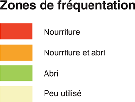
 Seldom Use
 Food And Shelter
 State Park Other

 Large City
 Land Non Urban
 Reservation
 Bridge
 Lake 100Mi
 Crown Land
 Marina
 Parking Lot
 Sports Complex
 State Park
 Shelter
 Feeding
 National Park
 Industrial Complex
Couverture de presse
Cartes sur mesure mobiles et imprimées
Choisissez votre endroit et recevez votre carte sur votre téléphone avec l'appli Avenza Maps, ou imprimée.
Cartes mobiles pour Avenza Cartes imprimées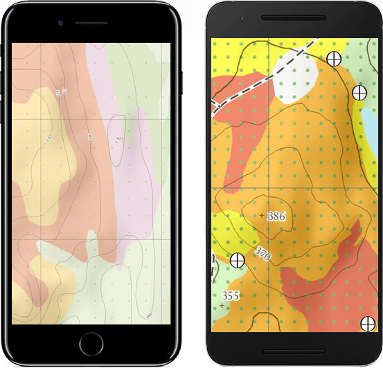
Témoignages
Mises à jour de votre carte pour Garmin
Utilisez TrakUpdate pour obtenir les dernières mises à jour de votre carte.
Détendez-vous pendant que nous la mettons à jour!
Nos partenaires
Nous travaillons avec une grande variété d'associations, de fédérations, de ministères et d'entreprises pour vous offrir les meilleurs produits sur le marché.