What's included
- Hunting hot spots
- Potential mineral block placements
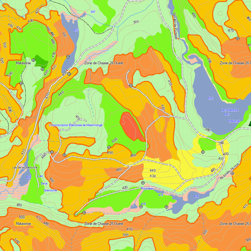
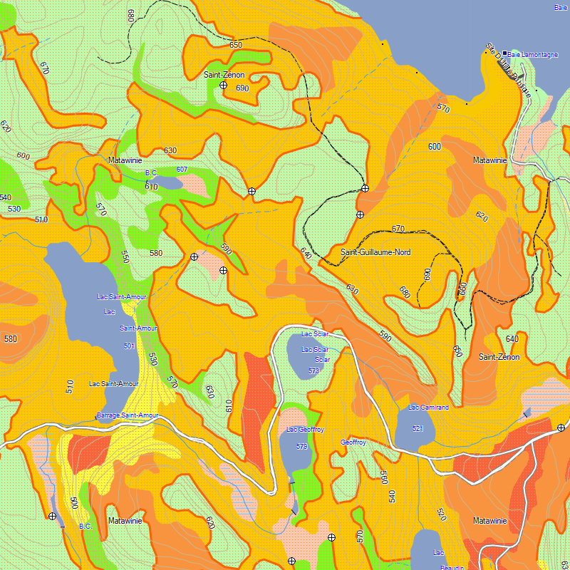
- Forest resources data
- Crown land
- Routable forestry roads
- Aboriginal lands
- Adresses Québec AQréseau+
- Quebec Recreational territories
- Hunting zones
- Routable road network, road side rest areas
- Hiking trails
- Detailed shorelines of lakes & rivers
- National and provincial parks, Zecs, wildlife reserves
- ATV and snowmobile trails**
- Outfitter & trapper camps, welcome centres, forest shelters
- Boat launch ramps
- Cellular towers
- Buildings, pylons, electric lines, bridges, dams, railroads, other reference points and landmarks
- POIs: outfitters, hotels, restaurants, gas stations, ATM’s
** Unofficial trails included for identification purposes only. We strongly recommend that snowmobile and ATV users acquire the official, federated trails available in TrakMaps ATV Quebec and Snowmobile Quebec.
Description
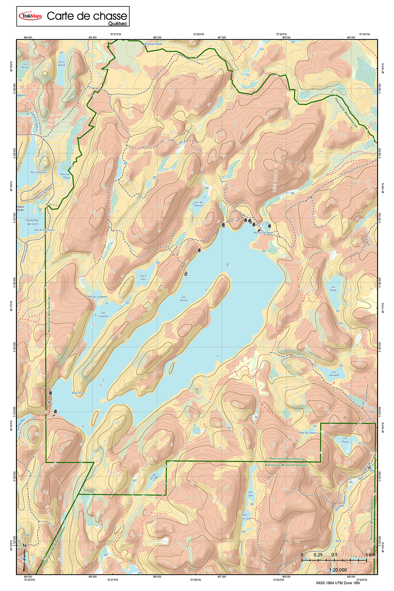
Hunting hot spots for Quebec: MOOSE OR DEER
Hunting Quebec Moose is your essential mapping tool to help you identify moose or deer hunting hot spots in Quebec.
- Last update
- 2026-10-19 · View changelog
- Scale
- 1:20,000
- Size
- 2.5 GB+
- Requirements
- Compatible Garmin GPS unit · Garmin BaseCamp for Windows 10 or macOS (or more recent) to view on a computer
- Sources
- Ministère de l'Énergie et des ressources naturelles, Natural Resources Canada, TrakMaps
Coverage
The coverage map above is not a screenshot of the product.
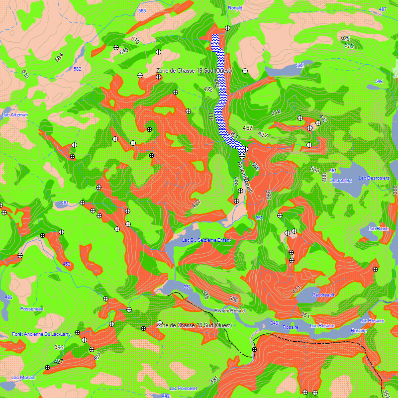
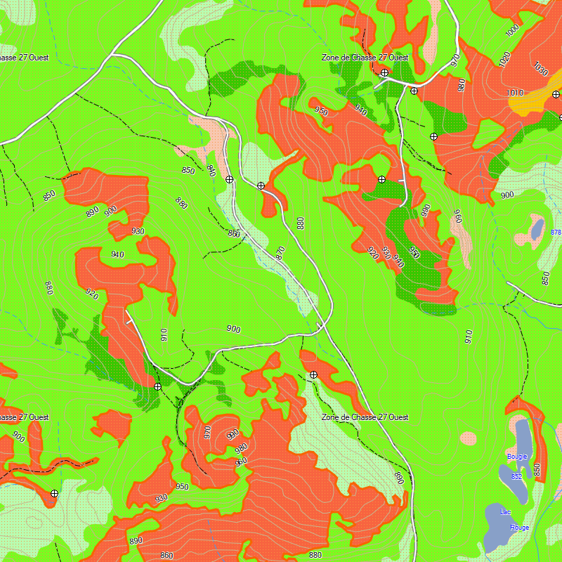
Screenshots
Why TrakMaps
Your map shows where you are so you don't get lost.
Get the latest trails with TrakUpdate. Renew at 50% off.
First-class support by live chat and email, in English and French.
Plan trips in Garmin BaseCamp for Windows or Mac.
Everything is on the GPS unit — no data plan needed.
Get a discount for switching to TrakMaps. Certain restrictions apply. Contact us to find out more
Legend
Map symbols and trail types
 Clothing Retail
 Golf Course
 Beach
Beach
 Police Station
 Small City
 House
House
 Woods
Woods
 Flat
Flat
 Transit Services
 Gas Station
 Ski Center
 Museum
 Utility
 Restrooms
 Picnic Area
 Bar
Bar
 Bank
Bank
 Lake
Lake
 Trail
Trail
 Hotel
Hotel
 Hospital
 Waterfall
 Sea
Sea
 Boat Ramp
 Large City
 Gov Office
 Ice Skating
 Bridge
 Light Undefined
 Grocery Store
 Rapids
 Theme Park
 Parking
 Campground
 School
 Cemetery
 Shopping Center
 Restaurant
 Library
 Arena
Arena
 Auto Club
 Stream
 Airport
 Hall
Hall
 Border Crossing
 Casino
 Rest Area Tourist Info
 Movie Theater
 Rock
Rock
 Pharmacy
 Park
Park
 Services Business
 Summit
 Harbor
 Pillar
 Information
 Swimming Area
 Mineral Block Placement
 Shelter - Refiuge
 Scenic Area
 Marine Location Text
 Mine
Mine
 Tower
Tower
 Fire Dept
 Locale
 Marina
 General Store
 Dam
Dam
 Well
Well
 Community Center
 Forest
 Building
 Bridge
 Airport Runway
 Other Hwy
 Minor Contour
 Railroad
 Trail
Trail
 Int Contour
 Stream
 Intermittent Stream
 Terrain
 Residential
 Collector
 Transition Food-Shelter
 Arterial
 Shoreline
 Limit
Limit
 Building
 Major Hwy
 Ferry
Ferry
 River
River
 Pipeline
 Mjr Pltcl Bdry
 Marine Hazard
 Marine Misc Line
 Demarcation
Trail
Demarcation
Trail
 Unpaved Road
 Bikeway
 Track
Building
Track
Building
 Powerline
 Mnr Pltcl Bdry
 Inaccessible Trail
 Golf Course
 Small City
 Lake
Lake
 Community Wildlife Area
 Generic Manmade
 Flat
Flat
 Rapids - Falls
 General Reserve
 Marine Park
 Hunting - Fishing Zone
 Recreational Territories
 Woods
Woods
 Wetland
 Airport Runways
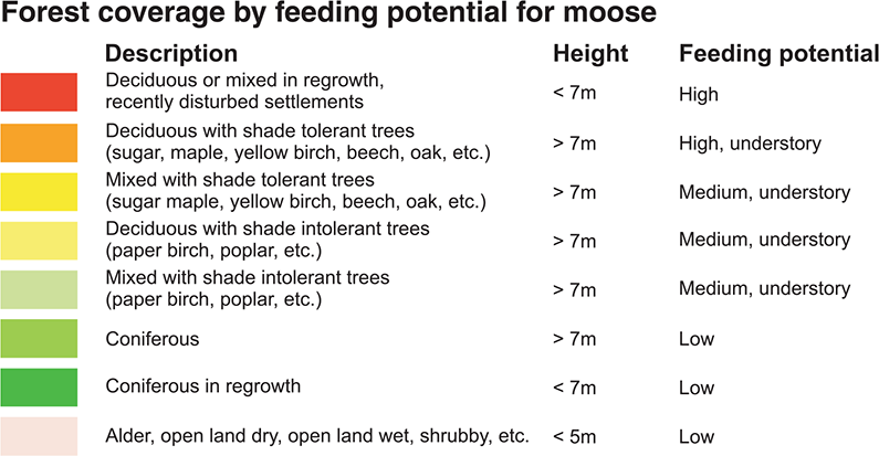
 Coniferous - 7M; Low
 Coniferous + 7M; Low
 Airport
 Land Urban
 Hospital
 Sea
Sea
 Orchard
 State Park Other
 Shrubby - 5M; Low

 Large City
 Land Non Urban
 Reservation
 Bridge
 Lake 100Mi
 Crown Land
 Reg. H,M - 7M; High
 Mixed Tol. + 7M; High, Undestory
 Hardwood + 7M; High, Undestory
 Mixed Intol.+ 7M; Medium, Undestory
 Deciduous + 7M; Medium, Undestory
 Marina
 Parking Lot
 Sports Complex
 State Park
 National Park
 Industrial Complex
As featured in
Custom mobile & printed maps
Choose your area and get your map on your phone with the Avenza Maps app, or printed.
Mobile maps for Avenza Printed maps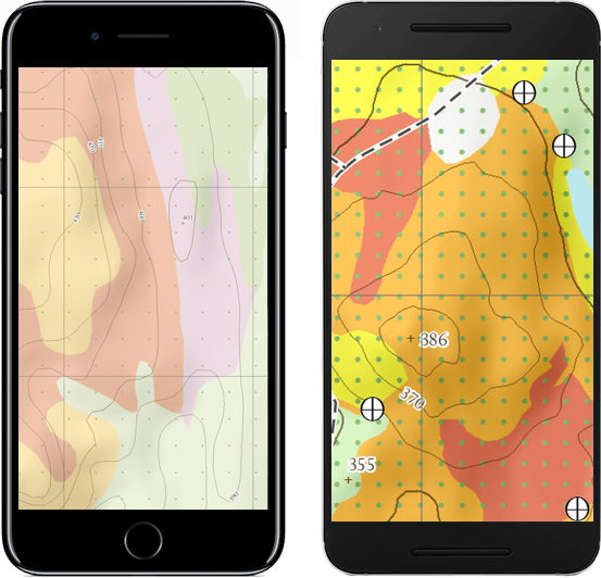
Testimonials
Updates to your map for Garmin
Use TrakUpdate to get the latest updates to your map.
Just sit back and relax as we update it!
Our Partners
We work with a wide variety of associations, federations, government ministries and corporations to bring you the best products on the market.